Welcome

This blog is intended to record the walks that I take before I forget the detail. These walks are not necessarily long or spectacular but I hope others will enjoy the blog.

I usually carry a camera and have started some Picasa web albums so that others can share the photos I take and comment on them if they like. Follow the link to my public albums

I hope you find the blog and the photos interesting.

A note on maps: I have started to embed Google Maps into some postings. These should add value by giving an idea of the locality of the walks. I have done my best to plot my tracks using the Google satellite view, but please take these as indicative rather than authorative. I would recommend carrying Ordnance Survey 1: 25000 maps when walking off roads in the UK.

Saturday, 14 May 2011

Brendon Hill and the West Somerset Mineral Railway Incline 9 May 2011


View Brendon Incline in a larger map

This was a short impromptu walk of only 3 miles. For me, the attraction was to walk the length of the inclined plane that took the West Somerset Mineral Railway to the top of the Brendon Hills.The web site for the railway has considerable detail about the incline and its workings and a leaflet and detailed maps are available in PDF format. The  gradient of the incline (1 in 4) and the length (just over 1 km) are given explicitly but if you want to know the height climbed you have to refer to the contours of the maps. Allowing 10m for the height of the embankment above the surrounding country at the summit, I make the total rise 245 metres, or nearly 804 feet.

Interior of the winding house
I have a well illustrated book about the Mineral Railway "The Old Mineral Line" by R. J. Sellick. My copy is a 1981 edition and I believe the book is currently out of print. The ISBN is 0 900131 39X. 

The weather on the day was reasonably pleasant with some sunshine but rain did not seem far away. I was lucky though and only experienced a few drops. I had intended to walk somewhere on the Brendon Hills in West Somerset but was undecided as to where. As I passed the site of the bridge at the top of the incline, I noticed that things had changed since I last stopped and looked around here. Whereas there used to be barbed wire and a sign saying "No public access", there is now a new gate and a more friendly sign to a "Permitted footpath".

Tunnel for a hauling cable
A path led from the gate to the winding house which was built into the embankment beneath the railway track. The side walls of the winding house have been rebuilt since the building was blown up in 1917 and I do not think the metal window frames are original. However, a tunnel that one of the two original hauling cables ran through still remains. Its upper end, where the cable would have emerged at track level, is not exposed; a pity, I think.

It is years since I last attempted to walk down the incline and, as I recall it was not possible to do so because of vegetation, fallen trees and some of the bank having been washed out. It is evident that much work has been undertaken to make it stable, well drained and passable on foot. From experience on the West Somerset Railway, I would say that ongoing work will be needed to keep it so.

Wooden railway sleepers have been placed across the incline at intervals as part of the restoration. I am sure these did not come from the original track as any sleepers left would have long since rotted away. I found some rail that had been put on one side, but it was fairly light bridge rail not the sort that I believe was used on the Mineral Railway. It seems more likely that this came from one of the narrow gauge tramways associated with the iron mines that the railway served.

A corroded rail chair
I also found a very corroded rail chair but, again, this seemed out of place given that R. J. Sellick's book has a photograph showing that, on the incline, the rails were spiked to the sleepers rather than held in chairs as elsewhere. On the basis that sane people do not casually carry heavy rail chairs on 1 in 4 inclines, I presume that it is still a rare, remaining piece of the railway's permanent way that was somehow deposited here.

Entrance to the dipping well
About a third of the way down the incline there is a hole in the eastern side of a rock cutting. Inside is a hewn out cave with a few inches of water in the bottom. I guess this is the "dipping well" shown on the Brendon Industrial Society's map. I confess to ignorance of what it was that was dipped. Further downslope, on the western side, the incline is supported by a high, butressed retaining wall. A railing has been built along the top of this to prevent accidents, but it is possible, with appropriate care, to leave the the incline for a few yards to see this impressive piece of engineering.

Butressed retaining wall


Towards the bottom, the incline becomes rather overgrown, but is passable. I followed what appeared to be the predominant path, but ended up scrambling down a steep drop finding myself on the track to Comberow farm to the south side of the bridge carrying the railway overhead. On passing under the bridge I saw that I should have crossed over the bridge and come down the nice new iron staircase that has been constructed - oh well!

Bridge carrying the incline over the road to Comberow Farm. The new steps are seen left of the arch
I have dwelt on the incline but make no apologies; it is interesting and worth a visit. The rest of the walk took me to the upper part of the valley that the Incline descends into. I can see no name for it in the map, but the stream flows down through Roadwater where it joins the Washford River which  eventually flows into Watchet Harbour. The lower section of the Mineral Line followed the valley all the way to the sea. The part of the valley above Comberow is quite enchanting. There is a network of footpaths but it seems an awful long way from human civilisation. Encountering hobbits, elves or the occasional wizard would not have altogether surprised me.

Deserted House
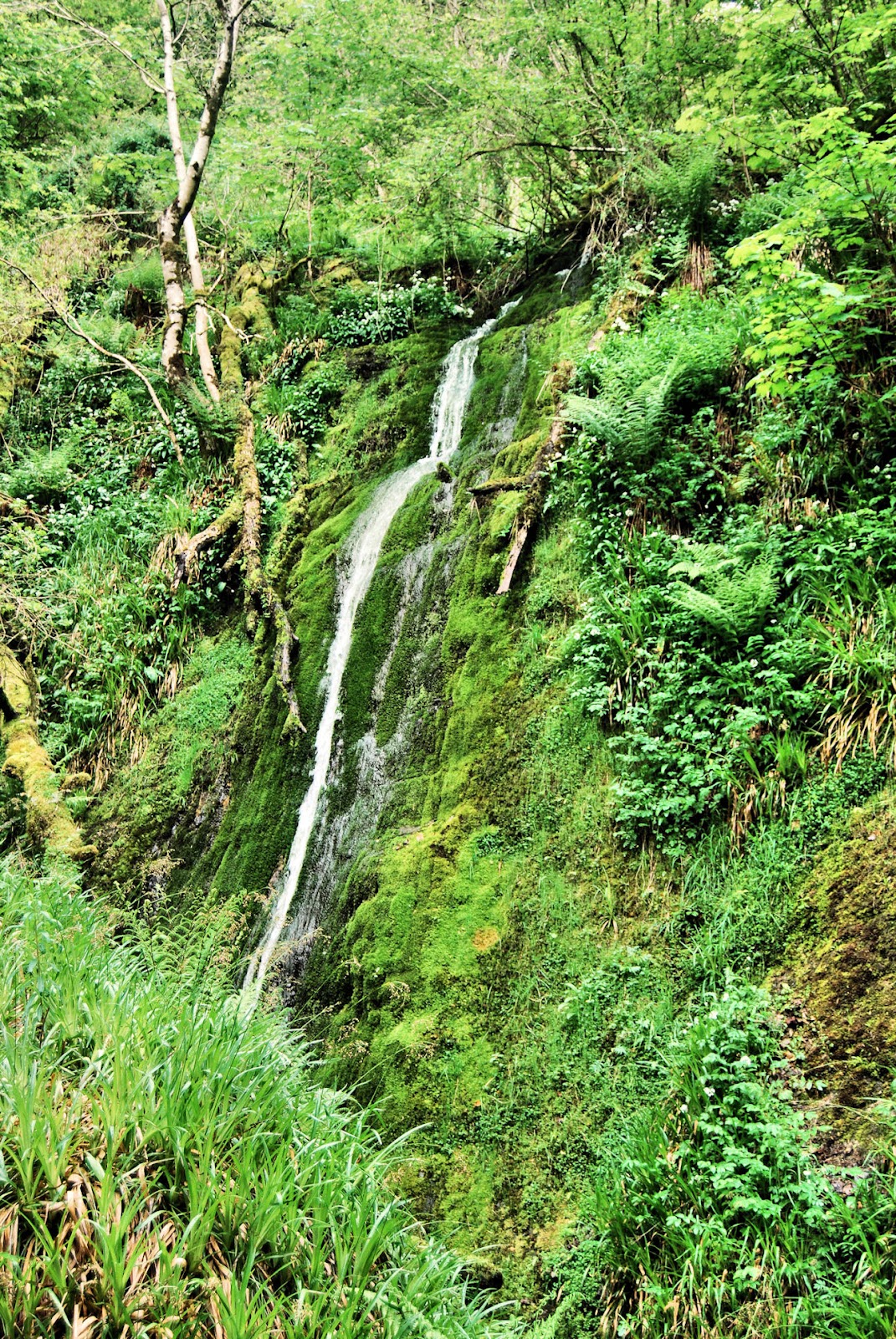
I took a path the northern side of the valley, towards Leighland Chapel. Either side were borders of bluebells and white wild garlic flowers. Looking down I got a clear view of Comberow with the farm buildings and a line of trees giving away the position of the Incline. At a junction I took a path that almost doubled back and went towards the head of the valley. The path did not fall much, but the gradient of the watercourse meant that it converged with the stream. The valley's sides are steep and wooded with some parts of its floor occupied by meadows. Suddenly though, the head of the valley is reached and there is an abrupt change in slope. I followed a fairly steep path, passing some moss and fern covered rock outcrops and eventually reached a wider track that bordered the woodland. This followed the contour around a tributary valley. I soon passed an uninhabited house that, although delapidated, still had its roof just about intact. I think that this is the same house that is pictured on Exmoor Encyclopedia web site's page on Treborough. If so, it has been exhumed from dense vegetation. Further along, there is a waterfall that cascades down a smooth rock face. The
height is difficult to estimate, but I would put it at 20 to 30 feet.

Waterfall
Beyond the waterfall the path follows the valley floor for a while before heading up a long slog to intersect the Incline. There was still a considerable 1 in 4 climb to get back to the winding house and the end of the walk.

This had been an interesting and enjoyable walk and I am sure I will further explore the area soon.

Sunday, 17 April 2011

Stogumber Station to Bishop's Lydeard Station via the Quantocks 12 April 2011


View Stogumber station to Bishop's Lydeard in a larger map

This was the longest walk I have undertaken for some time. It was 9.5 miles in length and took me 4.5 hours. I did not use the car, setting out from home and returning from Bishop's Lydeard by steam train on the preserved West Somerset Railway.

I have embedded the above Google map. This shows the route of the walk, but should be taken as indicative rather than authorative. For walking I recommend the use of paper 1:25000 Ordnance Survey maps. These show, for their date of publication, public rights of way and field boundaries, although both are subject to change. There are digital options but I have not used them.

The morning was a little chilly but it warmed up when the sun got higher. The day was mainly sunny with white cumulus clouds and a fairly strong breeze in exposed places. Visibility was fairly good and I decided that I would use my longer focus zoom lens and leave the standard one at home . I took an old 1980 Ordnance Survey 1:25000 map, Sheet 03/13. These were a smaller and far easier to handle out of doors than the current Explorer series but rights of way do change.

The first 1.5 miles were on the lane running from Stogumber station to the A358, the main road from Taunton to Williton. Stogumber station is actually in the parish of Crowcombe rather than Stogumber, but only just. The two place names were immortalised by Monty Python's Flying Circus

Having crossed the main road, I walked towards the centre of Crowcombe. After a couple of hundred yards I found to my left, opposite a thatched cottage,  steps leading to a path that gives access to the Quantock Hills. Having passed a garden and some chickens the path leads into  open pasture and continues uphill towards the open moorland. On this part of the route a couple of dodgy and difficult stiles have recently been replaced by new wooden gates. The fields had particularly pleasant spring green colour to them and trees were just coming into leaf.
 View from the meadows above Crowcombe

The path is not distinct here but you simply follow the signs with the Crowcombe estate woodland to the right and eventually come to the gate leading into the open country. There were none today, but I have seen deer in this area.

A narrow path then led through the heather and gorse, climbing again before levelling out somewhat and bearing right to join the track leading to Crowcombe Park Gate and eventually crossing the Crowcombe to Nether Stowey road.
The well trodden, old Quantock ridge road continues between trees. You cannot really see much from this road because of the trees and banks on either side, but at one point it was possible to get a view to the north east accross Bridgwater bay As soon as possible, in order to get better views to the west, I opted to use a gate that gave access to the open country above the steep, western, combe indented slopes of the hills. Trees are OK but too many make me feel penned up, so I was glad to get onto the open country. The prominence named Great Hill on the 1: 25000 map  is less wild than most of the Quantock ridge. It consists of open grassland with patches of gorse and trees. Before long there was a clear view of Wills Neck, the highest point on the Quantocks at 384 metres above the OS datum. It is also a Marilyn.
View of Triscombe quarry and Wills Neck from Great Hill
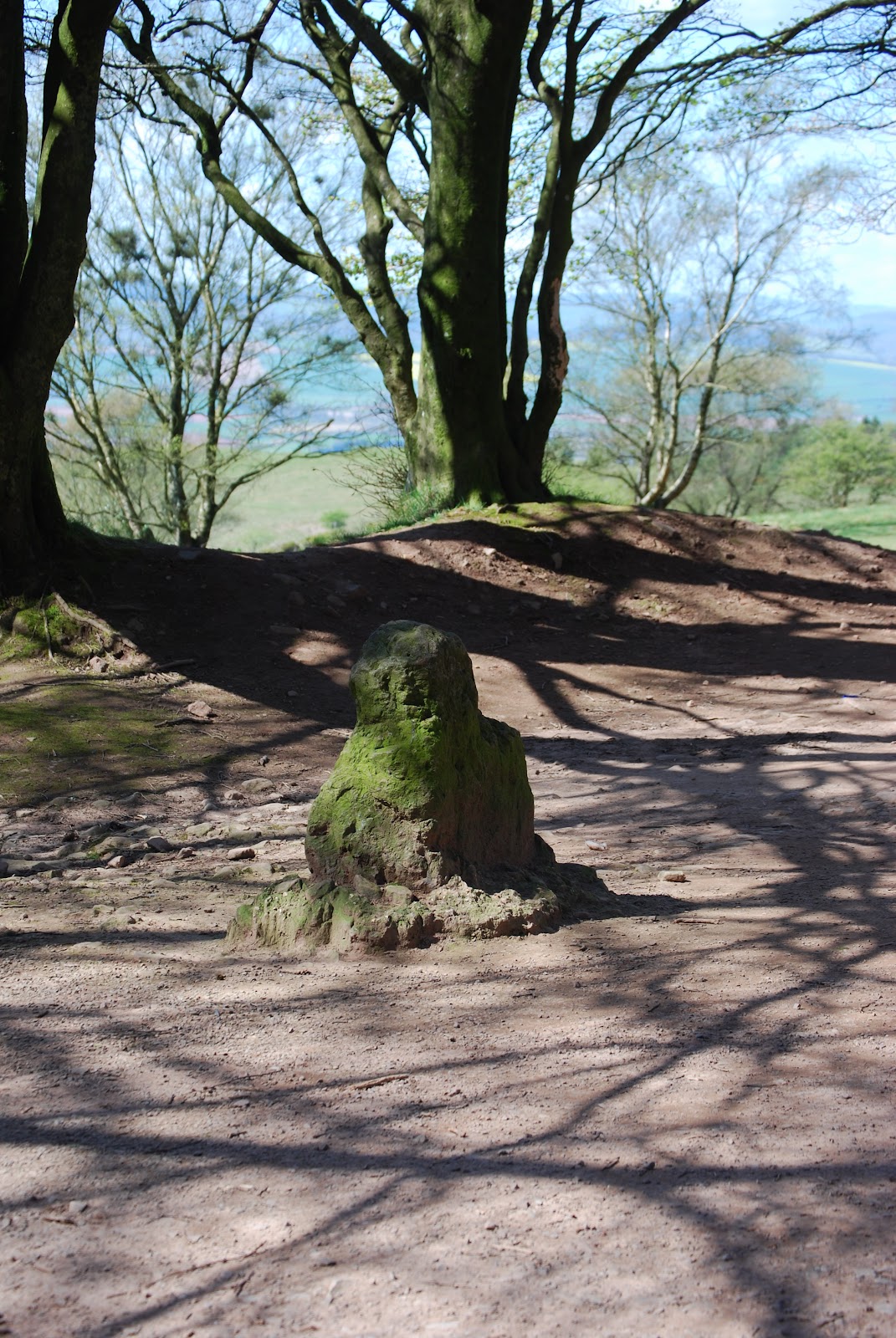
The next point of interest is the Triscombe stone. This is found at the junction of the ridge road, the track that climbs steeply past Triscombe quarry and the tarmac road that runs up Cockercombe giving road access from Nether Stowey and Bridgwater. It is not a spectacular monument, being only about 60 cm high, but it is thought to date back to the Bronze age. I have since found that there is an interpretation board about the Triscombe stone but I did not see it. I can believe its significance as the Quantock ridge route was an old drovers' road that in its day must have been important. There is a car park here and there were a few people enjoying the fine weather.

From the Triscombe stone, there is an easy climb to the summit of Wills Neck. As could be expected there were good all round views from here. The Ordnance Survey triangulation pillar here is part of their GPS network. Follow this link to an informative web site about trig pillars. It seems that they have their own enthusiasts.

It was too breezy to stop for lunch on Wills Neck, so I continued to the edge of the woodland above West Bagborough. There is a large depression here that contains a pond. The OS map contains the legend "Pits (disused)". So far I have not been able to determine what these pits, which I am sure are man-made, were used for.
The triangulation pillar on Wills Neck with Hinkley Point power station behind
Looking from near Wills Neck towards Minehead


After eating my packed lunch I continued along the ridge track before taking a left turn onto a track that descends steeply and leads directly to The Rising Sun pub in West Bagborough. The georgian Bagborough house is to the right of the track and a good view of it was available at one point.

Bagborough House
Most of the route to Bishop's Lydeard was on quiet country lanes across the lower countryside with a short stretch on a bridleway. I arrived at the station in good time to catch the 1605 train back to Stogumber.

While waiting for the train I noticed some old buses stored in a barn to the west of the station. I has not spotted these before assume that these belong to Quantock Motor Services Ltd. This company owns and runs a number of restored heritage buses as well as a more modern fleet. It has its depot right next to the station Most of the vehicles I could see in the barn looked to be in unrestored condition.


This had been a very enjoyable walk on a beautiful spring day but I was pleased to take my seat on the train for the journey back.
Buses stored near Bishop's Lydeard station

Monday, 7 March 2011

The Hangmen 3 March 2011

This was a 5 mile circular walk starting from Combe Martin in Devon. Including stops for lunch and photos it took me 2.5 hours.


View Combe Martin and the Hangmen in a larger map

At home in Stogumber we were greeted by early morning sunshine but on the way to Exmoor I ran into cold cloudy weather. The Met Office's current observations web page had shown  that sunshine lay to the west. This was borne out when I crossed the Somerset/Devon border. I was in continous sunshine until I travelled home, although it was rather hazy. It was also considerably warmer in Devon.

I followed the coast path leading east from Combe Martin. The path climbs  fairly steeply to Lester Cliff and beyond the part where it is edged by low trees there are good views back to Combe Martin and down to Wild Pear Beach.
Wild Pear Beach
 It is possible to access the beach from the Coast Path but the way down is not obvious and I did not spot it. Wild Pear beach is apparently frequented by naturists, but, I do not think they were around on this day.

 It did not take long the reach the summit of the Little Hangman. At 218 metres, this summit is 100 metres lower than the Great Hangman, but it is, in some ways, a more distinctive topographic feature. I have had a quick look around the Web to see if I could find out how these features got their names but I found nothing that could be substantiated.

This area is the type locality of the Hangman Grits which form much of the highlands of Exmoor and are exposed along the rugged coastline. The also form part of the Quantock Hills.
The view westward from Little Hangman
Little Hangman from the east. The Hangman Grits dip steeply to the north.
There is a deep cleft just to the east of Little Hangman and the rocks are well exposed. There is a gentle ascent from Little Hangman before the final climb to the cairn on the summit of Great Hangman. As you might expect, there are good views all round from this vicinity. To the seaward of Great Hangman there is a steep drop of 244 metres to the foreshore. This is the highest coastal cliff face in England. It would have be seen from the sea to really appreciate it.

Great Hangman from Little Hamgman

I would have liked to carry on along the coast towards Hunters Inn, which was only about 4.5 miles away, but I think getting back to Combe Martin by public transport would have been  problem. I took a path marked "Country Road" that headed south after leaving the open country and crossing a couple of fields the path became a concrete track leading into Girt Lane. Shortly after passing a house, I turned right into Knap Down lane. This is a well defined path that gives a direct route back to Combe Martin. From the lane there is a fine view across a valley towards Little Hangman.
Little Hangman from Knap Down Lane
The area around Combe Martin has a history of mining. In particular, silver was mined form the Middle Ages and the 1800s, but other metals, such as iron and zinc have also been extracteded.

This was an interesting walk on a day when Spring seemed to be properly on the way in North Devon if not in West Somerset.

Monday, 24 January 2011

Taunton to Bradford on Tone 11 January 2011 6.5 miles

This was a walk to fill in between two committments in Taunton several hours apart, thus avoiding a double run.
I have never followed the River Tone between Taunton and Wellington and the 1:50000 OS map shows that there are footpaths along the route which is called the West Deane Way. Following a wet spell. the weather looked fair for a few hours so it was a spontaneous idea to walk to Wellington and return by bus.


View Taunton to Bradford on Tone in a larger map

I actually started near the railway station in a place where I can park for free. I headed through town to the bus station, nearly a mile away, to check the bus times. Taunton has some good points but the town centre always fails to inspire me. The negative feeling was compounded by a sign on the enquiry/ticket office door to say "Closed today due to sickness". However, I did find a timetable for buses TO Wellington and buses were every 20 minutes. There was a total absence of information about when they returned but it seemed only slightly dangerous to assume that this would be at the same frequency!

The first part of the Walk was spoiled by construction work on Taunton's "third way". The normal riverside walk was closed so I had to make my way through car parks and past the Tesco supermarket before arriving at Firepool Wier. There was a great deal of water going over the wier due to the previous day's heavy rain. I crossed the footbridge over the wier to the north bank of the River Tone. From here the path follows the River Tone with Taunton's suburbia just to the north. However, a point of interest is the formation of the Parliamentary Cut. This was a short length of canal linking the Grand Western Canal to the River Tone. Its remains can be seen in the forms a linear depression yards to the north of the path. The Grand Western Canal ran from Taunton to Tiverton and is still navigable at the western end but long devoid of water near Taunton.

Further along. the path leaves the side of the river and crosses a new "country park" before leading past the park and ride off Silk Mills road. A small artificial lake has been created in this area.
Artificial lake at Roughmoor
After crossing the busy Silkmills Road and walking a few yards along Netherclay Lane I found the footpath through the new Netherclay woodland reserve. This area has recently been planted with trees which are small at present, but will change the nature of the area when they reach maturity.                                                                                                
Young trees (foreground) at Netherclay.
A ballast train heading onto the West Somerset Railway
In this area the power lines converging on the power distribution centre at Fideoke became fairly prominent and would remain so. The path stays north of the river and is closer to the railway line. North of the railway is Norton Fitzwarren, once famous for Taunton Cider which was made here until the company was taken over and asset stripped, closing in the 1990s. The cider works has now been flattened and housing is replacing it.

Norton Fitzwarren is also a railway junction. Today the preserved West Somerset Railway, running to Minehead, still diverges from the main line to the west of England. The WSR is constucting a triangle of track near the junction to allow trains to be reversed. A spin-off from this is that a site is provided by the WSR for the disposal of used ballast recovered from relaying the main line. A special train runs onto the WSR and deposits the ballast which is then recycled. Prior to the railway closures of the 1960s a line to Barnstaple also diverged from the main line here. Track has now been relaid on the first part of this and forms one side of the WSR's triangle

The path ran through pleasant enough, but rather soggy meadows close to the River Tone and crosses Victory Lane. Just before the Village of Bradford on Tone there is a wier and soon after  that I arrived at the 14th century bridge just to the south of the village. At this point I had taken longer than expected and had quite sore feet. I therefore decided to walk to the main road and get the bus back to Taunton.
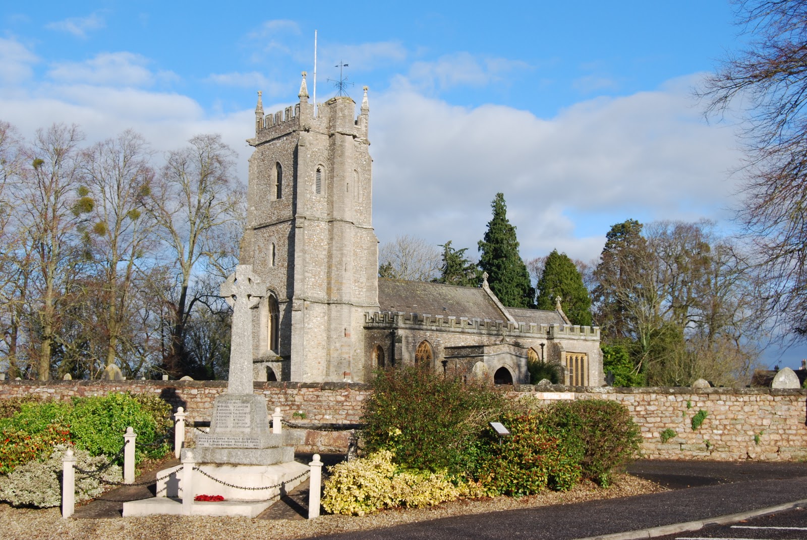
Bradford on Tone church and war memorial

Sunday, 7 November 2010

Halsway and Crowcombe via Halsway Post - 4 November 2010

For early November it was very warm, if rather windy, with temperatures around 16 deg C. In fact, when walking, it was warm enough to wear nothing heavier than a T shirt and I carried my waterproof jacket the whole way. The circular (actually more like a rectangle) 4.5 mile walk took me 2 hours 20 minutes.

Autumn Colours near Halsway Manor
I was able to park my car in a lay-by where a lane branches off the main A358 near Halsway Manor At about 1415 I set off up the lane to   Halsway Manor which is England's National Centre for Traditional Music, Dance and Song. The only dancing outdoors was the swirling of the falling leaves in the stiff breeze but the Autumn colours were impressive.

I followed a track just to the North-West of the manor that led quickly, but not all that steeply onto the open ground of the Quantock Hills. Unfortunately, the sky above the hills became dark grey. Together with the strong wind this made the moorland seem rather bleak and empty, just how I like it!

I turned left and headed towards Halsway Post, above the top of Halsway Coombe. There were the usual fine views to the West, even though visibility was reduced by a mellow haze that appeared to merge into low cloud over the Brendon Hills. The high parts of the Quantocks are now predominanty yellow and red-brown as winter approaches.

Autumn colours on the Quantocks above Halsway Combe
Although the hills themselves continues to be overshadowed by dark cloud, shafts of sunlight could be seen lighting up the vale between the Quantocks and the Brendons. This emphasised the contrast between the browns of the hills and the still lush greens of the lower ground. In fact, this year, with lower than usual rainfall in the late spring and early summer, the grass has seemed to grow better in the autumn than it did in the summer.

Near Halsway post a hunt became apparent in the form of a few 4 x 4 vehicles, the distant sound of a hunting horn and horseriders. No dogs though. The track along the top of the Quantocks is passable for 4 wheel drive motor vehicles and these can spoil a walk. As I got nearer to Crowcombe Park Gate I could see a collection of horse boxes parked off the road.


Before reaching Crowcombe Park Gate I left the msin track and took a narrow footpath which leads down to the north western end of Crowcombe village. At first though my route almost doubled back on itself before curving round to a more south westerly direction. The path leads to a gate beyond which it leaves the wild open country and crossed green pastures. It crosses a track using a pair of styles. One of these was in need of repair.
A shaft of sunlight over the green vale


The sun breaks through near Crowcombe
As I crossed the higher field the sun broke through a gap in the layer of cloud with a great golden blaze of light.
The route back to my car from Crowcombe was partly along the Quantock Greenway. The first part of this is a path that follows the A358 main road and is in places only a couple of yards from it. The second part goes through Halsway on a back lane. This is a detour but avoids a stretch where the road is narrow and ther is no verge to escape the traffic.

Wednesday, 27 October 2010

Alcombe Common and Dunster on 25 October 2010


This was a short 3.5 mile walk taking advantage of a brilliant sunny day. It took me a leisurely 90 minutes.

Rather than upload images twice, I have referred them to the URLs of images in my Picasa Web Album rather than upload them separately to the blog. Lets see how it goes.

I started from Alcombe near Minehead and walked up the road from the Britannia Inn towards the Youth Hostel. The track led through woodland and Autumn colours were showing.  I climbed past the Youth Hostel and onto the open ground of Alcombe Common. Excellent views over Minehead were revealed. Visibility was reasonably good and Wales was clearly visible.
Minehead and the Bristol Channel from Alcombe Common


I saw a steam train on the West Somerset Railway, making its way from Dunster to the terminus station at Minehead. It looked tiny from this distance.

A steam train on the West Somerset Railway
I climbed up to the ridge  and turned eastwards towards Dunster. After a short distance the path diveded. As indicated by signs the right hand path goes to Dunster via the Cemetary and the left hand one goes via Conduit Lane. I took the left fork and got a splendid view of Blue Anchor Bay on the way.

Blue Anchor Bay

Conduit Lane is a strange name, not very Somerset, but the trusty 1:25000 OS map shows that St Leonard's Well is on the route. Apparently, the well used to supply fresh water to a Benedictine priory that existed in Dunster. The water was conveyed to the priory via - yes a conduit. The priory was dissolved by King Henry VIII, but the church and some buildings remain. The well is in a stone building with a locked door. Pipework leads out of the bottom, so it looks as though it still supplies water to someone. The conduit is exposed at the bottom of the lane (a footpath) but no water was flowing, although the path had a dribble of water running down it.from the well.


I did not go into the village but turned left and after a few yards found Butter Cross, or rather, what is left of it. It seems to have lost its top part. The story goes that it derives its name from having been a meeting place where people sold butter. It used to be in the village but has been moved. The English Heritage website says it is managed by the National Trust.

I turned off the tarmac lane that goes past Butter Cross to take the right hand of two paths that would take me to the old A39 road, now a back lane, that would take me back towards Alcombe.

Sunday, 10 October 2010

Minehead to Porlock via the rugged coast path 7 October 2010

Distance - 8 miles
Time taken - 4 hours 30 minutes

It was a beautiful morning and the forecast was promising. I last did the "rugged" part of this route in December 2008 and have since had an ambition to walk from Minehead to Porlock and return by bus. So, off I went.


View Rugged coast path in a larger map


I left Minehead on the normal South West Coast Path. I was surprised to see that path had been visited by the guys who paint around potholes, so that months later, if the paint has not worn off, someone with a bucket of tar, fills them in in. This has struck me as being a wasteful process as it would surely be more efficient to send the tar out in the first place. This example should win a prize. It was not even a particularly deep hole.
Pothole?
I followed the track towards Greenaleigh Farm. This part of the route is wooded and there is only one place where you can look down and see Minehead Harbour. Trees are great, but I like to see out.
The path diverted from the track to the farm and went gently uphill. The trees eventually thinned out to give coastal views back towards Minehead.
Greenaleigh Point

The rugged alternative coast path is clearly signed where it diverts from the standard route.
The rugged path follows the coast around the area of pasture on North Hill. I think it is a much more interesting route than the standard path. It is the true coast path, having the essential quality of sea views. Today these were excellent, although it was a bit hazy. The route certainly involves more ups and downs and is harder work, but is not particularly difficult if you are reasonably fit. It is longer as a result of heading up into and out of several deep valleys (Combes).
Grexy Combe
To begin I had to descend into Grexy Combe and then climb back to the top of the cliff beyond.The next section is mostly easy, following a straight section of coast, although there was a short section where the path was eroding quite seriously above a steep drop. Near here I came across the biggest caterpillar I have ever seen.

A big caterpillar
I do not know what sort of moth or butterfly this will turn into but I think Air Traffic Control need to be informed. A couple I met had seen an adder.
At the end of a straight section a came to a point where the path turned south to go around Henners Combe. This was a good place to eat lunch as there were some rocks that made a dry place to sit down.At this point a good view of the coast to the west is revealed. Foreland Point was clearly visible. As it  was low tide I also had a glimpse of Selworthy Sand from here.

Looking West over Henners Combe
 The next section of the route headed along the eastern side of Henners Combe before crossing the two streams and then climbing up the western side. It was not far beyond this that the process was repeated to cross East Combe. There are better views of Selworthy Sand from here. The only way I know onto this beach involves using a knotted rope for support to get down the steep slope, consisting of loose rock, that is found at the back of the beack. The rope is tied at its upper end around a boulder. I have not dared try this.
Looking down on Selworthy Sand

After East Combe I followed the track to the top of Hurlstone Combe. I found that descending the steep path down the Combe was the most tiring part of the whole walk. Still there was no more serious climbing to do. I just had to follow the track to Bossington and along the lane to Porlock in time for the 15:23  No 39 bus back to Minehead.

This was a very  satisfying walk on a beautiful day surrounded by wonderful scenery